


The 4000km long Pacific Crest Trail is a mammoth undertaking by any measure, but with a rare medical condition that causes pain in sunlight, Cayla Danko faced an even tougher challenge on the famous long-distance trek…
The Pacific Crest Trail (PCT) is a 2650-mile trek from Mexico to Canada through California, Oregon, and Washington, and is undoubtedly one of America’s greatest wild and scenic trail experiences. Its dynamic wildernesses span a variety of environments including the southern California desert, rugged Sierra Nevada alpine terrain, Oregon/Washington temperate rain forests, and the Cascade mountain range.
From March to September 2022, my husband and I hiked the PCT, and it proved to be the adventure of a lifetime. We were ready for a completely new, life-changing experience, and the idea of breaking free from the mentally exhausting, career-based lifestyle, filled with societal norms and unnecessary pressures was more than enough to draw us into the wild and free spaces of the Pacific Crest Trail. Making the decision to attempt a thru-hike of the PCT, however, is not a choice to be taken lightly. It involves major lifestyle changes including career sacrifices, family commitments, housing adjustments, and fitness training; it also requires detailed financial and trip planning if you own a home, have pets that may need taken care of while you’re away, or have medical concerns that need to be properly addressed while on the trail, as I did. But despite the risks, we made the commitment to a new experience, secured permits in the lottery, and began planning our trek.
Cayla (aka Cheshire) hiking in central Washington, heading for Snowqualmie
Challenges
Every experience on the PCT is different. From a climate perspective, some years have major drought conditions, reducing reliable water sources and creating 20+ mile water carries. Other years have high snow levels making the Sierra Nevadas impassible for those without extensive mountaineering experience. Intense heatwaves can make it dangerous to complete the exposed, strenuous climbs and wildfires send hikers fleeing for safety.
Personal factors can also dramatically impact a thru hike. The experience will be different for someone who is more financially prepared than another, for someone who is in better physical shape than another, and for someone who has medical challenges. My experience with the PCT was particularly unique because I have a rare disorder called Erythropoietic Protoporphyria (EPP). Hiking the PCT with Porphyria may sound insane (the sun, the desert, exposed alpine environments – all normally send porphyria patients running for cover), but I was determined to take on the challenge.
Porphyria pain is intense and hard to picture for those without the disorder. Imagine going to the beach as a kid, but instead of enjoying a fun-filled day in the sun with your family, all you want to do is curl up in a ball and hide because it hurts so much to be outside; you can’t stand it. Tears swell up in your eyes as you bury your hands in the sand, hoping to find relief in the cool darkness under the surface. Instead, the scratch of the gritty granules on your skin intensifies the pain. You vigorously shake the sand off your hands in frustration and run down to the salty ocean water, only to find the feeling of the hot air unbearable against your skin after submerging in the cool water. The pain is excruciating – every change in texture and temperature seems to make it worse, but no one else can see it. They don’t understand. It is invisible. You just want to hide inside, alone, where no one else can see you.
I was diagnosed with EPP when I was 13. While finally understanding the reason for the pain was a relief, it didn’t make it easier. Some days were better than others, but every day outside was still a challenging traverse. I worked my way through high school sports, soccer, marching band, cross country, and track as the girl with the gloves who hid behind the trees, living through constant comments and misunderstanding.
In college, I discovered the world of caving and adventuring underground which became my favourite new hobby. The cool, damp darkness of a deep cavern brought me a sense of peace and pain-free outdoor experiences. But however strange, and despite the pain, I have always felt most at home deep in the mountains and far away from everyone else. I have been working my entire life to navigate life outside and was not going to let the sun stop me from a life well-lived.
Over the last 30 years, I slowly perfected my full-coverage sun protective suit (masks, gloves, hats, umbrellas etc.). In addition, just last year, the medical community discovered a way to reduce EPP sun-related pain. It’s an implant procedure that’s inserted every 60 days – while it doesn’t fix the problem, it reduces the intensity of porphyria pain for a short period of time. A lifetime of preparation and medical advances gave me the confidence to attempt such an intense journey, along the sun-exposed trails of the PCT.
Cheshire at Cajon Pass, California
The Southern Terminus
We started hiking on March 22. Getting to the southern terminus is the first adventure. It’s located near the remote town of Campo, California on the Mexican-US border. We rented a car to drive 16 hours from our home to San Diego. From there we took a train to El Cajon, a bus to Campo, and then walked down an unfamiliar dirt road to a trail angel’s horse farm about a mile north of the terminus. This is where we spent our first night.
This was our first experience with a trail angel. Trail angels are selfless, generous, caring people who help thru hikers on their journey. They genuinely want to see hikers succeed and are all over the world if you know where to look!
We heard about this particular trail angel from a few other hikers who told us, “Just head over to their place and they will welcome you with open arms.” I was nervous at first – leaving my home, traveling to an unknown area, and hoping that a stranger would let me stay on their property. But just as other hikers mentioned, they welcomed us, and 20 other hikers, with open arms to a family-style spaghetti dinner in their backyard and allowed us to camp on their property the night before our start date.
Day one was a crazy mix of emotions from sheer excitement to nervousness and stress. It was the start of a journey with an endless state of unknowns – the people, the places, the process, all of it. When we woke up at 7am, everyone had already packed their tents and were on their way to the terminus; we felt behind. We were alone. When we set out from the southern terminus, however, we never felt alone again. At the 4-mile mark there was a creek with the last water for 16 miles until Lake Morena. There was a pile up of hikers relaxing at the creek. Everyone was cheerful when we arrived, chatting about their water carry plans, and eating snacks. It was our first time attempting a dry camp and we ended up carrying way too much water.
Our first night we camped at mile 11.4 after 482m of elevation gain. We were tired and feeling very out of shape compared to those around us. We were the last ones to arrive at camp and nine other hikers were already setting up in the space. Despite our last choice sloped and rocky campsite, we spent the evening meeting new friends, chatting about life, eating dinner and staying up way past hiker midnight (aka after sunset). The crew of hikers we met that night were some of the most incredible people, all with diverse backgrounds and stories. In the morning, I wanted to keep up with the people we had recently met. I wanted to join them as a ‘tramily’ (trail family). I quickly realised however, that you need to hike your own hike. Forcing yourself to physically keep pace with people who walk faster than you, or go further than you, could lead to a hike-ending injury.
We had to take the time to get into shape before we could even consider pacing with a group of people. While we started the trip in okay physical condition, we were clearly not in thru hike shape. We started with a target of eight to 12 miles per day in mind – giving ourselves the grace of time to get into shape – but this proved harder than expected. The next several weeks would push ourselves mentally and physically to new heights, beyond anything I could have imagined.
We hiked 77.3 miles in our first week on the PCT from the Southern Terminus to Scissors Crossing. It was our longest backpacking stretch ever! We felt exhausted but accomplished and excited at the same time. Many people abandon their PCT thru hike in the first week, so we were proud of the miles we’d covered and the mental clarity we had gained about the idea of a thru hike.
This is where it all changes though – the thru hike reality sets in. After a week backpacking, most people head home, shower, clean gear, recharge with a home-cooked meal and go back to normal life. This time however, we would hitch-hike 20 miles down an unfamiliar mountain road, fight for a hotel room to hide from the oncoming late-winter storm, wash our laundry in an old sink, and purchase overly salty packaged goods to re-supply, head back to the trail and continue north – a completely different lifestyle that we would grow to love and appreciate.
After finally securing a room and taking our first shower in a week, we headed to the local bar where we were greeted by 20 other hikers with a boisterous cheer. It was a successful first week on trail. We were home.
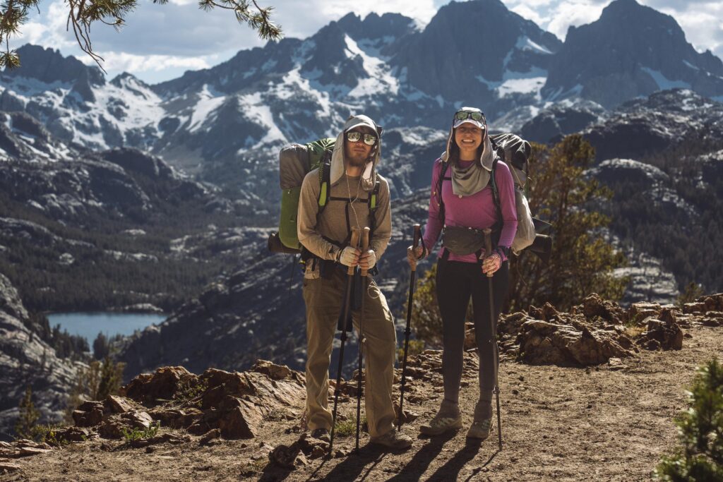
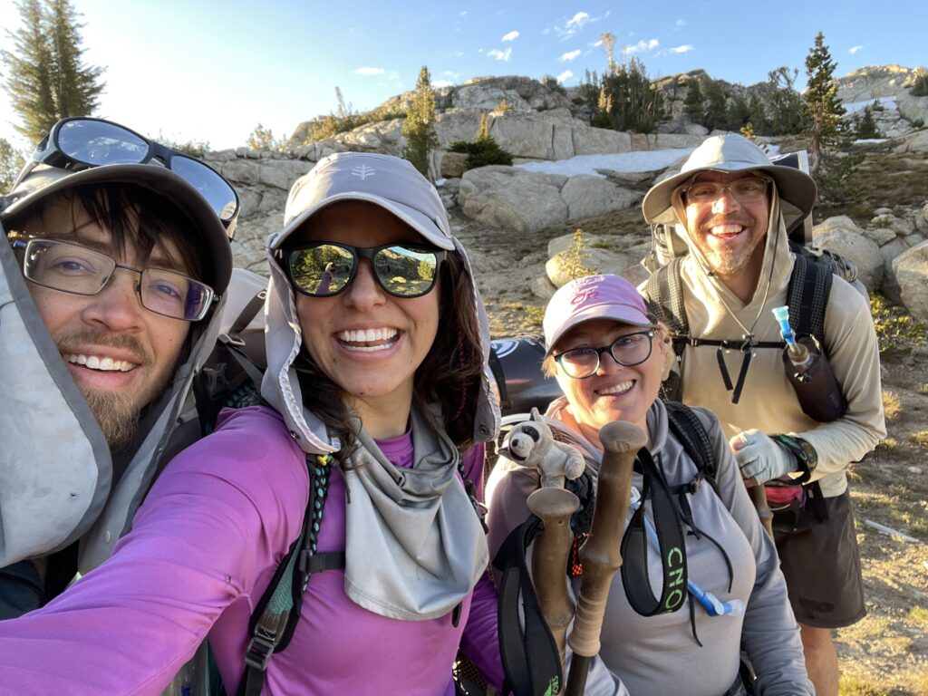
Chesire and BLT, fresh out of Mammoth Lakes with a full resupply in the Sierra Nevada Mountains IMAGE: Josh Murphy
Southern California Desert
Our first 60 days on the trail were in the southern California desert which is approximately a 700-mile section of the PCT. The desert scenery was incredibly diverse and so were the trail challenges. A thru hike forces you to learn adaptability and change your planning mindset. Your 10-mile target for the day may not be an option. 10 miles could put you in the middle of a steep 1000m climb with cliffs on both sides of the trail, or put you in the middle of a long town road walk with nowhere to sleep, forcing you to decide, “Do I hike eight miles today, or 15 miles?” Those decisions quickly turned into, “Do I hike 17 miles today, or 21 miles?”
The desert section of the PCT passes through both sandy foothills and alpine terrain. The stark differences within a few miles continued to blow my mind every day. During week one the trail passed through the Cleveland National Forest, the Laguna mountains, Hauser wilderness, and had insane views of the Sawtooth mountains, Anza-Borrego desert and several reservations. We saw hundreds of lizards, snakes, and birds. We even laughed ourselves to sleep at night as we listened to wild desert turkeys gobbling in the moonlight.
We also crossed the San Jacinto, San Bernadino, and San Gabriel mountains during our time in the southern California desert while encountering 20+ mile water carries, 80mph wind gusts, and both intense heat and freezing cold during the same day. This section also offered the opportunity to summit San Jacinto (3301m) and Baden-Powell (2867m) which many thru hikers often complete.
We summited Baden-Powell on our PCT journey. The approach to the summit was completely covered in fresh snowfall from a recent storm and there was no clear path. We blazed our way to the top, post-holing through deep snow and pushing our way upward. At the time, it was the highest altitude that we had ever climbed to and despite the clouds restricting our view of Los Angeles to the west, the feeling was incredible.
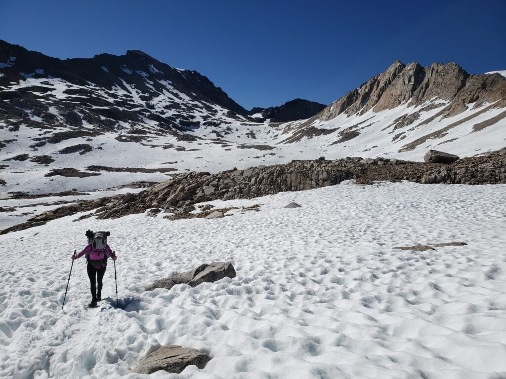
Cayla and Joe hiked 7 miles over the Kearsarge Pass to resupply and then back again to rejoin the PCT
Navigating Medical Complications
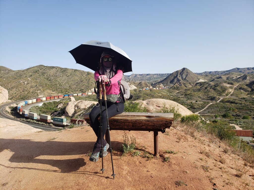
Around mile 485 you approach the Mojave desert and the LA aqueduct. This is a historically hot and dry, but immensely unique, part of the PCT. The Mojave was a terrifying landscape for me as someone with Porphyria and my implant was quickly wearing off. We needed to get off the trail and head back to Oregon for my next implant before taking on that part of the desert.
Having Porphyria impacted our trail experience. As we hitch-hiked off trail, everyone we met over the last 450+ miles continued north. I assumed we’d never see our trail friends again. But that’s the beauty of the PCT – there are other hikers making their journey north every day and you never know who you will see again.
Once my implant arrived and I had the procedure, we made our way back to the trail immediately with the help of an incredible trail angel who picked us up from Santa Clarita, California, and drove us almost two hours up a long dirt road and back to the exact mile we departed trail. In my haste to get back on trail however, I did not allow my body time to absorb the implant and pushed out into the Mojave sun without the extra protection. We hiked onto the LA aqueduct and skirted the Mojave desert when I was only two days post implant procedure. I was determined to get moving again, but my hips ached in pain from the insertion point and my skin was starting to hurt on my face. After the aqueduct, the trail continues through several miles of shade-less, water-less windmill farms, intensifying exposure to the elements with every step. After climbing out of the Mojave, I experienced my first on-trail Porphyria reaction. My UPF clothing, mask, gloves, hat, and umbrella were no match for the Mojave sun and Tehachapi desert winds.
In retrospect, it was a mild reaction compared to those I had before implant, but by the time we hitched into town, I could barely stand the pain. I just needed to be inside. There was nowhere to take shelter in that section of the PCT. There were no trees, no buildings, not even bushes to crawl underneath and hide. Even those without Porphyria crowded under umbrellas and behind the rare shade of a Joshua tree for relief. After that, we changed our hiking strategy for the last section of the desert from Tehachapi to Kennedy Meadows South. We woke at 3am to hike several miles before sunrise and before the heat intensified for the day. We would siesta under a Joshua tree for six plus hours and wait for dark to hike again, well into the night.
Dry camp along a ridge in northern California
Sierra Nevada Mountains
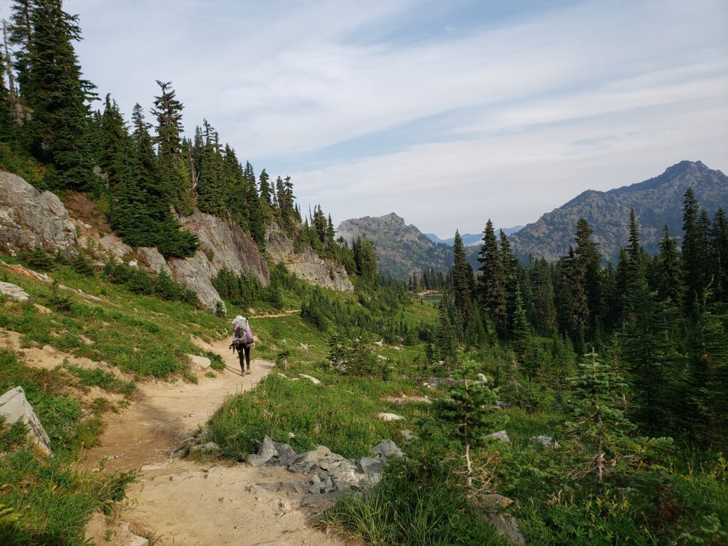
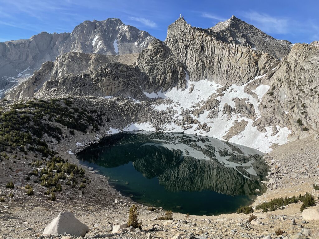
There was a dramatic change in scenery upon leaving the desert and entering the Sierra Nevada mountains in central California. Stark cliffs rise toward the sky. Plentiful water flows from the snow above. Pine trees line the valleys. Trails rise above 3500m for hundreds of miles. Temperatures drop below -7 degrees Celcius. Changes in elevation increase to 1200m+ every day. Blood-thirsty mosquitos flood the skies. The trail crosses Forester Pass, the highest point on the PCT at 4023m. Pristine alpine lakes lurk around every corner and fluffy little marmots chirp loudly from their rocky perches in the background.
The PCT overlaps with the John Muir Trail (JMT) for approximately 160 miles. Bear canisters and snow gear are required, dramatically increasing pack weight. The trail crosses over a high-mountain pass almost every day, changing your hiking strategy. It became critical to position camp within a mile of the high passes at night to ensure a firm snowpack for safe passage early
in the morning. Entry and exit for resupply became challenging, requiring eight to 13 miles of hiking one-way over another mountain pass to exit the range and resupply back down on the desert floor. This led to eight (or more!) day food carries and extended timelines in remote areas of the wilderness. It was in the Sierras where we truly appreciated the disconnect from society; it was an immersive wilderness experience.
After completing the Sierra Nevadas, we returned home briefly for another EPP implant. This time I was more patient, understanding that our PCT experience was our own and that I needed the implant to safely continue forward. I had to take a deep breath.
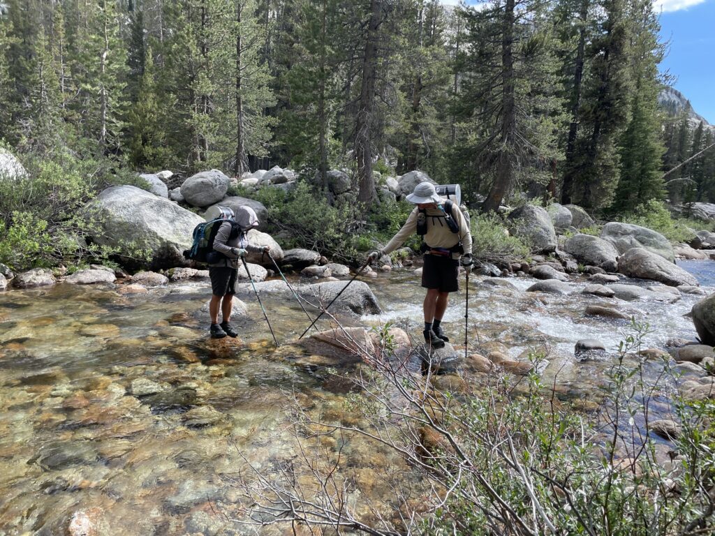
Purple and Cookie Monster crossing a creek in Yosemite
Northern California
As the PCT transitions to the northern section of California, hints of the desert return to the landscape. Our trail-legs were strong, and we averaged 22 miles per day in this section. We experienced temperatures up to 42 degrees Celcius. It was relentlessly sunny and I was grateful for a fresh implant. NorCal, however, is where we experienced our first wildfire on trail. A classic, uninterrupted thru hike of the PCT is almost an unreasonable expectation with the current impact of climate change on our environment. While I knew going into our hike that wildfires were a real concern, I secretly hoped it wouldn’t happen.
After hiking around the base of Mount Shasta, we were heading towards Etna, California during an intense heatwave when we encountered a line of 15 hikers quickly moving in the opposite direction. They informed us of an explosive wildfire that sparked the night before and that we needed to head out immediately. I reached out to my family on our Garmin and confirmed the dangers up ahead. We joined the hikers quickly fleeing south for a way out. The McKinney fire unfortunately closed over 100 miles of the PCT during our hike, including the California/Oregon state border crossing. We hitched north to Ashland, Oregon to continue our PCT trek.
Oregon
When we arrived in Ashland, the skies were heavy with smoke and the ash was hard to breathe. Almost half of the PCT in Oregon was closed due to new wildfires. Many thru hikers were making plans to end their trip, skip Oregon and head to Washington, or to flip-flop and travel straight to the Northern Terminus to hike southbound. After talking to a few other southbound hikers, we decided to continue north in Oregon, and I am so glad we did.
The PCT in Oregon travels along the base of several volcanos including Mount Jefferson, the Three Sisters and Mount Hood. It circles around Crater Lake, the deepest lake in America at 592m deep. It passes through lush temperate rainforests with beautifully tall trees, gorgeous alpine lakes, stunning meadows, and flowing rivers. Even though we had to hitch around several wildfire trail closures in Oregon, we were so glad we hiked as much of it as we safely could.
Cheshire approaching Muir Pass in the Sierra Nevada Mountains
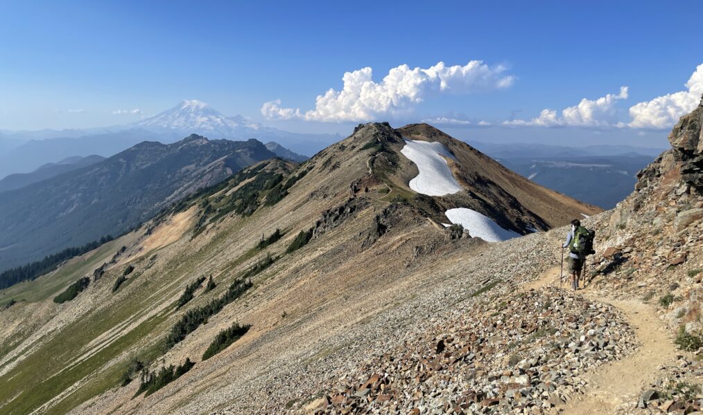
Washington
The PCT crosses into Washington over the Bridge of the Gods – a toll bridge spanning the Columbia River. Walking into the final state of the PCT was a feeling like no other – complete disbelief and pure joy simultaneously. The threat of wildfire was imminent, but we pushed north while we safely could.
The trails in Washington were beautiful but steep, challenging our bodies to maintain big miles while tackling 1500m gain through numerous blow downs and landslides. The trail rises high along the base of Mount Adams while Mount Rainer and Mount St. Helens tower in the background as you push north. It winds along ridges with beyond breathtaking views. Raspberries and huckleberries dot the landscape, tormenting you as you try to speed by.
I remember saying to my husband, “How am I ever supposed to reach Canada when there are so many berries?” The thought of fresh fruit after five months of dried food was too mouthwatering to pass up.
As we hiked north, dangerous wildfires continued to spark all around us. Unfortunately surrounding the northern terminus and closing the trail to the Canadian border. While this was heartbreaking for everyone who didn’t have the opportunity to tag the
northern terminus, it’s the harsh reality of climate change in the pacific northwest. Aggressive wildfires make the area unpassable but force you to remember the delicate balance and appreciate what time you had on that most incredible, beautiful, Pacific Crest Trail.
Hiking the PCT is an experience of a lifetime, the trail living up to its hallowed reputation. With beauty and challenges unparalleled, the PCT will make an impact on your heart. Whether you hike 20 miles or 2000, it is truly unforgettable and extraordinary.
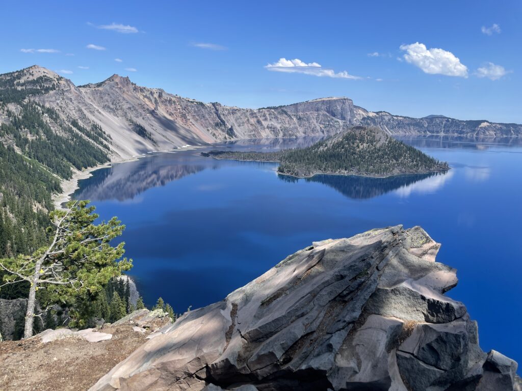
Crater Lake, Oregon
The Knowledge
Essential info to know before you go:
Climate:
Varied and seasonal; PCT Thru-hikers must be prepared for almost all conditions and terrains, from dry desert to high alpine snow.
When to go:
Northbound (Nobo) permits (Mexico to Canada) are issued March-May; Southbound (Sobo) permits (Canada to Mexico) are issued June-July.
Permits:
Long distance permits are required for trips longer than 500 miles on the PCT. They can be acquired through the PCTA during an annual permit lottery – visit www.pcta.org.
How to get there:
Most hikers begin their journey from San Diego, California. There is ground transportation available via train to a bus which will then take you to Campo, California – the location of the southern terminus for NOBO hikers.
Trip length:
4-6 months depending on fitness level and seasonal weather impacts.
Maps & navigation:
Options for purchase: National geographic has paper maps available for each section of the PCT. For those who prefer digital, FarOut has an interactive map of the PCT with trail details, campsites, water sources, etc. which is extremely useful for thru-hikers.
Re-supply:
There are places to resupply every 3-9 days on the PCT. Re-supply quality and variety varies greatly however, from convenience stores, to grocery stores, to outdoor gear shops with backpacking meals. Many hikers send food and supplies to local town post offices in towns where shops are limited, especially if you have special diet considerations.
BLT, Cheshire, Purple and Cookie Monster, reunited after several weeks in Yosemite
What is EPP?
Erythropoietic Protoporphyria (EPP) is a rare inherited metabolic disorder characterized by a deficiency of the enzyme ferrochelatase (FECH). Due to abnormally low levels of this enzyme, excessive amounts of protoporphyrin accumulate in the bone marrow, blood plasma, and red blood cells. The major symptom of this disorder is hypersensitivity of the skin to sunlight and some types of artificial light, such as fluorescent lights (photosensitivity). After exposure to light, the skin may become itchy and painful. Affected individuals may also experience a burning sensation on their skin. The hands, arms, and face are the most affected areas. Some people with Erythropoietic Protoporphyria also have complications related to liver and gallbladder function (American Porphyria Foundation, 2021).
WORDS: Cayla Danko (Trail name: Cheshire)
IMAGES: Cayla Danko, Joe Powlus (Trail name: BLT)